geotrace homework help
Boost your journey with 24/7 access to skilled experts, offering unmatched geotrace homework help

Trusted by 1.1 M+ Happy Students
Recently Asked geotrace Questions
Expert help when you need it- Q1:Directions: Answer the following questions in approximately 3-5 sentences. Type your responses to each question below. Please use regular font style (i.e. do not italicize, bold, or underline your responses). 1. What is a mineral? What criteria do we use to define a mineral?See Answer
- Q2:2. One of the following substances is a mineral, and the other is not: liquid water (H₂O) and solid ice (H₂O). Identify which one is the mineral and which one is not. Explain why the latter is not a mineral.See Answer
- Q3:3. One of the following substances is a mineral, and the other is not: amber (C10H160) and a seashell (CaCO3). Identify whichone is the mineral and which one is not. Explainwhy the latter is not a mineral.See Answer
- Q4:4. While trekking in the granitic San Gabriel Mountains near Los Angeles, CA, you find an interesting mineral (see pictures below). It has a vitreous (glassy) luster, pinkcolor, and you can see two distinct cleavage angles. You cannot scratch it with a copper penny nor glass plate, but you can scratch it with a steel nail. The sample you found is particularlyneat, but you also notice that the granite rocks around you have a lot of this mineral in them. What is the name of this mineral? How did it form?See Answer
- Q5:5. While hiking on the shoreline of an ancient, inland ocean, you find an interesting mineral (see pichae below). It has a non-metallic vitreous luster, andyoucansee three distinct cleavage angles. You cannot scratch it with your fingernail, but you can scratch it with a copper penny. You put a drop of HCl on its surface, and you see a reaction. What is the name of this mineral? How did it form?See Answer
- Q6:6. While vacationing in the Smoky Mountains in North Carolina, you find a vein filled with a white mineral. (see pictures below). The mineral has a non-metallic, vitreous luster and a conchoidal fracture. You cannot scratch it with a steel nail, but you can scratch it with a piece of topaz. What is the name of this mineral? How did it form (there are a few ways that the mineral could have formed in the vein- suggest at least one)?See Answer
- Q7:7. While taking Instagram selfies near a volcanic vent in Hawaii (and paying attention so as to not get distracted and step in hot lava), you find an interesting rock (see picture below). It has a very dark color, no visible crystals, and vesicles that look like air bubbles. What is the name of this rock? Is it igneous, sedimentary, or metamorphic? How did it form? Did it form on the surface or underground?See Answer
- Q8:8. While hiking in a steep mountain valley, you find an interesting rock outcrop (see picture below). It is a mix of sand, gravel, and large boulders, and it appears to have been deposited in layers. What is the name of this rock? Is it igneous, sedimentary, or metamorphic? How did it form?See Answer
- Q9:9. There are five geological events represented in the diagram below: deposition of Layers A-D and the creation of Fault E. List the five events in order from oldest to youngest. What type of fault is Fault E (normal, reverse, or strike-slip)? How do you know?See Answer
- Q10:10. Consider the diagram below. There is an underground magma chamber feeding a volcano on the Earth's surface. As the volcano erupts, lava moves down its flanks, cools, and solidifies into rock After a very long time, the underground magma also cools and solidifies into rock. How will the rocks that make up the volcano differ from the rocks that formed in the magma chamber? Explain.See Answer
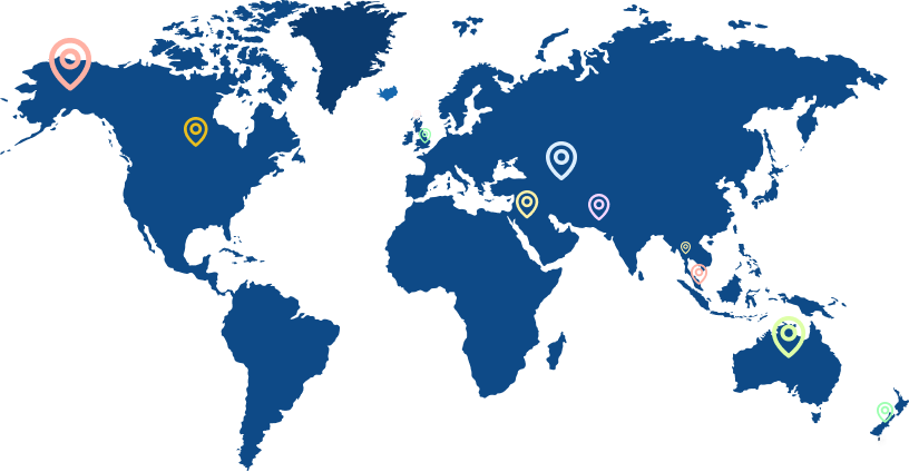
- Q11:11. For this question, please load the Plate Tectonics.kmz file in Google Earth. This file shows the locations of plate boundaries represented with lines. Note the legend; each type of boundary is represented by a different line color: Consider three pairs of cities: (1) Palm Springs and Yucca Valley, California, USA; (2) Mecca, Saudi Arabia, and Port Sudan, Sudan; and (3) Lahore, Pakistan and Leh, India. For each pair of cities, are the cities moving towards each other, away from each other, or parallel to each other? How do you know? (Hint: Search for each pair of cities in Google Earth and look at their locations relative to the nearest plate boundary. The first pair of cities is shown below. The plate boundary is represented by the blue line.)See Answer
- Q12:12. For this question, please load the Plate Tectonics.in file in Google Earth. The file shows the location of earthquakes that occurred from 2016-2017 represented as dots. Note the legend; the depth of the earthquake focus is represented by the color of each dot. Look at the Pacific coast of South America near the intersection of the boarders of Argentina, Bolivia, and Chile (see image below). Do earthquakes become deeper towards or away from the coast? What type of plate boundary is located here, and how does it explain this phenomenon?See Answer
- Q13:13. For this question, please load the Plate Tectonics.n-file in Google Earth. The file shows the location of volcanoes represented as triangles. Look at Pacific coast of Guatemala, El Salvador, Honduras, and Nicaragua (see image below). Would you expect the volcanoes here to be shield or composite (strato) volcanoes? Why? Would you expect the volcanoes to be effusive (i.e. calm) or explosive? Why? (Hint: Look at the type of plate boundary along the Pacific coast. Recall that we discussed how this type of boundary creates volcanism.)See Answer
- Q14:14. EARTHQUAKE! Seismometers all over the world measure a violent, magnitude 9.1 earthquake. Using the difference in arrival times between the P-wave and S-wave, US Geological Survey stations in Denver Colorado, Honolulu Hawaii, and Anchorage Alaska all measure their distance from the epicenter: . Denver: 1820 kon • Hawaii: 3990 kon Anchorage: 2320 km Where did the earthquake occur? What type of plate boundary is located here? Are there any post- earthquake hazards that might affect people living nearby? (Hint: Find Denver, Colorado in Google Earth. Then, clickon the "Ruler" tool and select "Circle". Now, draw a circle with a radius of 1,820 kon centered on the city. Repeat for the other two cities.)See Answer
- Q15:15. What type of rocks are located here in the Dayton area? Approximately how old are they? How was the Dayton area different back then relative to today? Additional Hints: • Throughout this course, I have frequently reminded you that there are three important minerals to remember: Feldspar (particularly Orthoclase Feldspar), Quartz, and Calcite. What are the chances that these minerals are the answers to Questions 4, 5, and 6? Throughout this course, I have frequently reminded you that there are six broad categories of igneous rock and that there are two important ones to remember: Granite and Basalt. What are the chances that one of these is the answer to another question? • Throughout this course, I have frequently reminded you that there are four broad categories of sedimentary rocks to remember: Conglomerate, Sandstone, Shale, and Limestone. The first three are differentiated by the size of their grains (Conglomerate has the largest grains and Shale has the smallest), and Limestone is made of the calcite skeletons of tiny sea creatures. Conglomerate tends to form in mountainous headwaters, Shale and Limestone tend to form in oceans or large lakes, and sandstone tends to form between those locations. What are the chances that some of these four rocks are the answers to a few more questions?See Answer
TutorBin Testimonials
I got my Geotrace homework done on time. My assignment is proofread and edited by professionals. Got zero plagiarism as experts developed my assignment from scratch. Feel relieved and super excited.
 Joey Dip
I found TutorBin Geotrace homework help when I was struggling with complex concepts. Experts provided step-wise explanations and examples to help me understand concepts clearly.
 Rick Jordon
TutorBin experts resolve your doubts without making you wait for long. Their experts are responsive & available 24/7 whenever you need Geotrace subject guidance.
 Andrea Jacobs
I trust TutorBin for assisting me in completing Geotrace assignments with quality and 100% accuracy. Experts are polite, listen to my problems, and have extensive experience in their domain.
 Lilian King
I got my Geotrace homework done on time. My assignment is proofread and edited by professionals. Got zero plagiarism as experts developed my assignment from scratch. Feel relieved and super excited.
Joey DipI found TutorBin Geotrace homework help when I was struggling with complex concepts. Experts provided step-wise explanations and examples to help me understand concepts clearly.
Rick JordonPopular Subjects for geotrace
You can get the best rated step-by-step problem explanations from 65000+ expert tutors by ordering TutorBin geotrace homework help.TutorBin helping students around the globe
TutorBin believes that distance should never be a barrier to learning. Over 500000+ orders and 100000+ happy customers explain TutorBin has become the name that keeps learning fun in the UK, USA, Canada, Australia, Singapore, and UAE.