https://publicpagestutorbin.blob.core.windows.net/%24web/%24web/assets/arts1_1df8912735.png

Geography Homework Help | Geography Assignment Help

Avail geography assignment assistance- Post queries to get guidance from the best geography homework helpers.

https://publicpagestutorbin.blob.core.windows.net/%24web/%24web/assets/arts2_a7e37da123.png

Trusted by 1.1 M+ Happy Students

Place An Orderand save time
man
phone
  • United States+1
  • United Kingdom+44
  • Afghanistan (‫افغانستان‬‎)+93
  • Albania (Shqipëri)+355
  • Algeria (‫الجزائر‬‎)+213
  • American Samoa+1
  • Andorra+376
  • Angola+244
  • Anguilla+1
  • Antigua and Barbuda+1
  • Argentina+54
  • Armenia (Հայաստան)+374
  • Aruba+297
  • Ascension Island+247
  • Australia+61
  • Austria (Österreich)+43
  • Azerbaijan (Azərbaycan)+994
  • Bahamas+1
  • Bahrain (‫البحرين‬‎)+973
  • Barbados+1
  • Belarus (Беларусь)+375
  • Belgium (België)+32
  • Belize+501
  • Benin (Bénin)+229
  • Bermuda+1
  • Bhutan (འབྲུག)+975
  • Bolivia+591
  • Bosnia and Herzegovina (Босна и Херцеговина)+387
  • Botswana+267
  • Brazil (Brasil)+55
  • British Indian Ocean Territory+246
  • British Virgin Islands+1
  • Brunei+673
  • Bulgaria (България)+359
  • Burkina Faso+226
  • Burundi (Uburundi)+257
  • Cambodia (កម្ពុជា)+855
  • Cameroon (Cameroun)+237
  • Canada+1
  • Cape Verde (Kabu Verdi)+238
  • Caribbean Netherlands+599
  • Cayman Islands+1
  • Central African Republic (République centrafricaine)+236
  • Chad (Tchad)+235
  • Chile+56
  • China (中国)+86
  • Christmas Island+61
  • Cocos (Keeling) Islands+61
  • Colombia+57
  • Comoros (‫جزر القمر‬‎)+269
  • Congo (DRC) (Jamhuri ya Kidemokrasia ya Kongo)+243
  • Congo (Republic) (Congo-Brazzaville)+242
  • Cook Islands+682
  • Costa Rica+506
  • Côte d’Ivoire+225
  • Croatia (Hrvatska)+385
  • Cuba+53
  • Curaçao+599
  • Cyprus (Κύπρος)+357
  • Czech Republic (Česká republika)+420
  • Denmark (Danmark)+45
  • Djibouti+253
  • Dominica+1
  • Dominican Republic (República Dominicana)+1
  • Ecuador+593
  • Egypt (‫مصر‬‎)+20
  • El Salvador+503
  • Equatorial Guinea (Guinea Ecuatorial)+240
  • Eritrea+291
  • Estonia (Eesti)+372
  • Eswatini+268
  • Ethiopia+251
  • Falkland Islands (Islas Malvinas)+500
  • Faroe Islands (Føroyar)+298
  • Fiji+679
  • Finland (Suomi)+358
  • France+33
  • French Guiana (Guyane française)+594
  • French Polynesia (Polynésie française)+689
  • Gabon+241
  • Gambia+220
  • Georgia (საქართველო)+995
  • Germany (Deutschland)+49
  • Ghana (Gaana)+233
  • Gibraltar+350
  • Greece (Ελλάδα)+30
  • Greenland (Kalaallit Nunaat)+299
  • Grenada+1
  • Guadeloupe+590
  • Guam+1
  • Guatemala+502
  • Guernsey+44
  • Guinea (Guinée)+224
  • Guinea-Bissau (Guiné Bissau)+245
  • Guyana+592
  • Haiti+509
  • Honduras+504
  • Hong Kong (香港)+852
  • Hungary (Magyarország)+36
  • Iceland (Ísland)+354
  • Indonesia+62
  • Iran (‫ایران‬‎)+98
  • Iraq (‫العراق‬‎)+964
  • Ireland+353
  • Isle of Man+44
  • Israel (‫ישראל‬‎)+972
  • Italy (Italia)+39
  • Jamaica+1
  • Japan (日本)+81
  • Jersey+44
  • Jordan (‫الأردن‬‎)+962
  • Kazakhstan (Казахстан)+7
  • Kenya+254
  • Kiribati+686
  • Kosovo+383
  • Kuwait (‫الكويت‬‎)+965
  • Kyrgyzstan (Кыргызстан)+996
  • Laos (ລາວ)+856
  • Latvia (Latvija)+371
  • Lebanon (‫لبنان‬‎)+961
  • Lesotho+266
  • Liberia+231
  • Libya (‫ليبيا‬‎)+218
  • Liechtenstein+423
  • Lithuania (Lietuva)+370
  • Luxembourg+352
  • Macau (澳門)+853
  • North Macedonia (Македонија)+389
  • Madagascar (Madagasikara)+261
  • Malawi+265
  • Malaysia+60
  • Maldives+960
  • Mali+223
  • Malta+356
  • Marshall Islands+692
  • Martinique+596
  • Mauritania (‫موريتانيا‬‎)+222
  • Mauritius (Moris)+230
  • Mayotte+262
  • Mexico (México)+52
  • Micronesia+691
  • Moldova (Republica Moldova)+373
  • Monaco+377
  • Mongolia (Монгол)+976
  • Montenegro (Crna Gora)+382
  • Montserrat+1
  • Morocco (‫المغرب‬‎)+212
  • Mozambique (Moçambique)+258
  • Myanmar (Burma) (မြန်မာ)+95
  • Namibia (Namibië)+264
  • Nauru+674
  • Nepal (नेपाल)+977
  • Netherlands (Nederland)+31
  • New Caledonia (Nouvelle-Calédonie)+687
  • New Zealand+64
  • Nicaragua+505
  • Niger (Nijar)+227
  • Nigeria+234
  • Niue+683
  • Norfolk Island+672
  • North Korea (조선 민주주의 인민 공화국)+850
  • Northern Mariana Islands+1
  • Norway (Norge)+47
  • Oman (‫عُمان‬‎)+968
  • Palau+680
  • Palestine (‫فلسطين‬‎)+970
  • Panama (Panamá)+507
  • Papua New Guinea+675
  • Paraguay+595
  • Peru (Perú)+51
  • Philippines+63
  • Poland (Polska)+48
  • Portugal+351
  • Puerto Rico+1
  • Qatar (‫قطر‬‎)+974
  • Réunion (La Réunion)+262
  • Romania (România)+40
  • Russia (Россия)+7
  • Rwanda+250
  • Saint Barthélemy+590
  • Saint Helena+290
  • Saint Kitts and Nevis+1
  • Saint Lucia+1
  • Saint Martin (Saint-Martin (partie française))+590
  • Saint Pierre and Miquelon (Saint-Pierre-et-Miquelon)+508
  • Saint Vincent and the Grenadines+1
  • Samoa+685
  • San Marino+378
  • São Tomé and Príncipe (São Tomé e Príncipe)+239
  • Saudi Arabia (‫المملكة العربية السعودية‬‎)+966
  • Senegal (Sénégal)+221
  • Serbia (Србија)+381
  • Seychelles+248
  • Sierra Leone+232
  • Singapore+65
  • Sint Maarten+1
  • Slovakia (Slovensko)+421
  • Slovenia (Slovenija)+386
  • Solomon Islands+677
  • Somalia (Soomaaliya)+252
  • South Africa+27
  • South Korea (대한민국)+82
  • South Sudan (‫جنوب السودان‬‎)+211
  • Spain (España)+34
  • Sri Lanka (ශ්‍රී ලංකාව)+94
  • Sudan (‫السودان‬‎)+249
  • Suriname+597
  • Svalbard and Jan Mayen+47
  • Sweden (Sverige)+46
  • Switzerland (Schweiz)+41
  • Syria (‫سوريا‬‎)+963
  • Taiwan (台灣)+886
  • Tajikistan+992
  • Tanzania+255
  • Thailand (ไทย)+66
  • Timor-Leste+670
  • Togo+228
  • Tokelau+690
  • Tonga+676
  • Trinidad and Tobago+1
  • Tunisia (‫تونس‬‎)+216
  • Turkey (Türkiye)+90
  • Turkmenistan+993
  • Turks and Caicos Islands+1
  • Tuvalu+688
  • U.S. Virgin Islands+1
  • Uganda+256
  • Ukraine (Україна)+380
  • United Arab Emirates (‫الإمارات العربية المتحدة‬‎)+971
  • United Kingdom+44
  • United States+1
  • Uruguay+598
  • Uzbekistan (Oʻzbekiston)+998
  • Vanuatu+678
  • Vatican City (Città del Vaticano)+39
  • Venezuela+58
  • Vietnam (Việt Nam)+84
  • Wallis and Futuna (Wallis-et-Futuna)+681
  • Western Sahara (‫الصحراء الغربية‬‎)+212
  • Yemen (‫اليمن‬‎)+967
  • Zambia+260
  • Zimbabwe+263
  • Åland Islands+358
*Get instant homework help from top tutors—just a WhatsApp message away. 24/7 support for all your academic needs!

Geography Assignment Help For All Academic Levels

Geography assignment help is essential for students at all academic levels, providing tailored support to meet their unique needs. Whether you're a high school student or studying in college, expert assistance can enhance your understanding and performance. Clear explanations, comprehensive research, and accurate data interpretation ensure students can confidently complete their assignments with the help of geography homework. By utilizing these services, learners can improve their grades by developing a deeper understanding of concepts & their applications.

Expert Assistance For Quality Learning

It is a fact that some subject courses in humanities are relatively easy, though you cannot say the same thing about Geography. The coursework of this subject is elaborate, especially if you are pursuing it in your advanced studies. The subject requires enormous time and effort. However, only time and effort cannot help students do well in geography. They need expert guidance that helps them overcome their study challenges and makes learning impactful yet easy.

With the TutorBin Geography homework helper team, students can meet their requirements quickly without stress. Our geography homework experts offer assistance to develop the necessary skills and knowledge base, which also boosts the learning capacity of students. Geography homework writers guide students effectively to do their tasks accurately without copying someone else's work. Besides, experts also give you an in-depth understanding and create a positive learning environment for students. Whenever you opt for our expert help with geography homework, you get the chance to experience quality learning.

Geography Homework Help

Who can seek Expert Guidance?

When discussing geography help for students, let us dive deeper and see who can seek expert subject assistance. If you are in college, it's not new to you that several types of students opt for guidance. However, we have divided them into three categories depending on the reasons. Firstly those with a limited understanding of the subject. These types of students lack conceptual clarity and need thorough guidance from experts. The second category is for students with time constrictions. These college-goers face hurdles due to insufficient study time for family issues or part-time jobs. The third category includes those who know the subject but need help developing their skills or clarifying their doubts. Our geography helper assists all of them to ensure they get better learning scopes.

Geography Tutor

What Makes it worth to hire them For homework help?

It's quite obvious if "Is it worth to hire a geography tutor" raises its head in your mind. You are not alone who think this way. This question bothers other students too. Here, we will tell you why it is worth to get assistance from arts homework help experts if you are planning to ace geography.

Collaboration with expert professionals leverages your learning capacity and helps you to become competent in your subject. Meaningful academic guidance from our experienced domain experts assists students in overcoming study struggles. It clears doubts, improves students' subject knowledge, and increases learning inclination. Our geography helper try their best to cover all your academic requirements and ensure that you taste academic success with the help of proper guidance.

Geography Homework Helper

Challenges That Push Students Towards Guidance

Study hurdles are an integrated part of learning for students. From a subject knowledge gap, lack of practice, and doubts to insufficient skills, anything can become a challenge to achieving academic success. Thus, identifying the major challenges and understanding the impacts is significant to overcome these. TutorBin has pointed out some of the common challenges Geography students face. If you are in the same situation, it's time to ask for assistance from our geography homework helpers.

1) Not having an in-depth understanding

One of the familiar yet major problems college students encounter is the lack of developing a geographical understanding of the subject's key concepts. Students often could not grasp these concepts as they thought it would be better to emphasize coursework more than developing conceptual clarity. Therefore, they failed to develop the understanding needed to ace geography.

2) Lack of remembering important information

The cognitive ability to remember significant information is a major requirement for students pursuing geography in their advanced education. Unable to do so enhances the chance of mistakes, which also toughens for students to perform well. In the long run, students also lose interest in this subject.

3) Absence of an analytical Skill

For middle school, rote memorization often works fine, but mastering this subject requires strong analytical skills for advanced study pursuers. Lacking analytical skills prevents students from analyzing data, maps, and photographs accurately to draw realistic conclusions. It hampers their task and reduces their chances of flourishing as successful geographers.

4) Lack of critical thinking ability

Critical thinking ability while analyzing information is one of the significant skills that enhances your chances to do better as a geography student. It distinguishes fact from opinion to make better insight into information. Critical thinkers examine the evidence for tasks and consider what alternative solutions they have. The absence of this skill affects the ability to analyze information and makes it difficult for students to get accurate and informed conclusions.

5) No or less visualization power

Geography is also heavily dependent on maps and graphs. A strong visualization power enables students to come up with maps and graphics, clearly stated and understandable. Lack of visualization skills makes it hard for students to communicate data and the content of the map with clarity.

Geography Homework Assistance

How It Makes TutorBin Special For Students?

Adhere to International Education Standards- Our team of experts is specially trained to offer guidance by adhering to different international educational standards. Whenever you seek assistance from experts, our team ensures that you get homework help geography that suits the academic standards of your college, no matter what standard it follows.

Customized subject assistance online- Our team of homework help geography experts provides personalized assistance to students depending on their needs of the students. Our experts consider the learning styles of individuals and then customize guidance to ease their study hurdles. We make sure that it eases your academic challenges and simplifies subject understanding.

Direct communication with students- The third reason that made us preferable to students is the facility to communicate directly with experts. Sharing your problems with experts helps students to express their requirements. It assists subject specialists in understanding what students are expecting from them. The process reduces the chance of confusion and assures students that they are in good hands.

Detailed explanations to simplify tasks- It's not the answers that matter; it's the detailed explanation that tells your professors how much you know about the topic. Our domain experts are well aware of it. Thus, they provide thorough explanations to ensure you understand the topic. It's their main aim to make it simple and easily understandable.

Prompt response from domain experts- Whenever you take our help with geography homework, we try to respond as quickly as possible. It may take 2 to 3 minutes, but not more than that. Our team ensures that promptness remains intact, enabling experts to help students without wasting time. The prompt response, punctuality, and fast expert guidance make TutorBin special for students.

Geography Help

Topics & Concepts Experts Cover

TutorBin professionals are not only subject experts but also have vast experience helping students learn. These domain experts committedly offer their time and effort to ensure that students get assistance depending on their requirements. Our team has experts for more than 500+ subjects who caters all your do my homework requirements. It does not matter which topics and concepts bother you; our professional subject specialists are always ready to give you every kind of geography help, irrespective of your academic level.


Physical geography Human geography
Social geography Applied geography
Political geography Economic geography
Geomechanics Geographic information science
Geoinformatics Geographical information systems
Global Positioning System Remote sensing

Geography Assignment Help

9 Benefits Students Get By Opting This Service

More than 50% of students have acknowledged that getting expert assistance from a geography homework helper was one of the best decisions they have taken for their academics. Here, our experts will show you why students think so and the reasons that made educational experts recommend geography homework writing assistance for college students.

1) Verified Geography experts

The team of subject matter experts is one of the main reasons students get benefitted whenever they ask for geography homework help services. Our verified experts are highly qualified and have extensive experience in offering academic guidance. Whenever we choose subject specialists, we ensure they have proven track records.

2) Maximum time & effort to boost academic knowledge

For academic assistance, it's the time and effort of experts that counts most. TutorBin experts are well aware of it. Therefore, they always commit their time and put in maximum effort to assist students whenever they ask for help with Geography homework answers. This continuous support boosts the subject understanding of students and fills their knowledge gap.

4) Inexpensive homework assistance

TutorBin aims to provide meaningful study help to students to improve their academic knowledge. That's why TutorBin always believes students should focus on learning first and then consider expenses. Affordable expert assistance from our experts is the outcome of this thought.

5) Flexible time for study assistance

Believing that education has no boundaries, TutorBin has created its platform where students can opt for expert help for their studies, irrespective of their subject and academic levels. It doesn't matter where you live or what time would be your perfect time to study; TutorBin is flexible enough to assist you at your convenience.

6) Original work report

Original work is one of the major setbacks that students often invite. It has grave consequences. Thus, it is always a good decision to refrain from copying. For better academics, you can opt for the TutorBin Geography homework writing service. It guides you to come up with accurate and unplagiarized tasks. For assurance, it also gives original work reports.

7) Unlimited access to the library

Whenever students become confused about geography homework answers, they want to confirm the accuracy of their answers. Our library has huge answer sets on diverse subjects. Students can check it without paying any extra charges. It provides a positive and engaging learning environment for students. This access not only clears their doubts but also increases their academic inclination to a great extent.

7) Round-the-clock expert support

One of the biggest benefits students get from our geography homework doers online is the 24/7 support, even at odd hours. Our geography homework experts are known for their uninterrupted guidance that helps students to do homework and study without the stress of time boundations.

8) Multiple revisions as per requirements

Our geography homework experts understand that revision is important if the task requires some modifications to align it with the given instructions. Thus, our experts are open to multiple revisions if students feel modification is needed for improvement, even after completing the task.

9) Privacy of student's personal information

As a reliable website, TutorBin takes student Secured account very seriously. We understand that there could be negative consequences if you share personal information. TutorBin adheres to a strict non-disclosure policy to prevent personal information sharing with third parties.

Geography Homework Assistance

Instant Support From Experts

Let us reveal the secret behind the popularity of TutorBin's Geography Homework Help experts. It's the instant support from these dedicated professionals that has won the hearts of millions of students. Our geography homework writers, with extensive experience, are well-versed in addressing the challenges faced by students. This commitment to providing reliable Geography Homework Help, coupled with their dedicated professionalism, establishes TutorBin as a go-to platform for students seeking assistance with geography assignments. Our team initiates the quickest possible assistance that connects students with the best-suited professionals whenever you ask for "Do My Geography Homework Right Now." The promptness of our expert geography helper team makes the homework assistance process smooth, quick, and easily accessible.

Geography Homework Writing Assistance

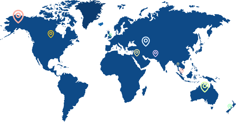
Expert Guidance For Geography Assignment Worldwide

When it comes to academics, our experts understand that guidance should be the priority instead of location boundaries. This mission enables them to offer expert study assistance worldwide. Whether you are in the USA, UK, UAE, Canada, Singapore, or any other country, TutorBin experts don't hesitate to offer them guidance. The assistance enhances the clarity of subject concepts, and students also get in-depth knowledge on diverse Geography topics.


Geography Homework Helper Available 24/7

One of the best things about our geography homework helper team is its 24/7 availability, offering students round-the-clock academic support. Students can get assistance at any time during late-night studies or early-morning deadlines. Experts offer help, considering that students can get timely help, no matter whenever they encounter challenges. By relieving students from the study burden and the stress of tight deadlines, TutorBin established itself as a reliable academic help platform.

FAQs Searched For Students

Can you do my geography homework?

If you are looking for geography help, then TutorBin can become your best choice. Our experts offer assistance that helps you to get accurate and original work homework within a short time. Our professionals help you understand concepts and explain questions to simplify your homework.


How long will it take to write my geography homework answers?

There is no set timeline for questions. We generally take 3-5 hrs to submit homework. However, depending on the question's complexity, deadline, and expert availability, it may vary.


Can an average student afford geography help online?

For affordable and quality Geography Homework Help, turn to TutorBin. As an average student, access expert assistance within a reasonable budget, along with exciting benefits. With TutorBin, homework help is at your fingertips, ensuring a harmonious blend of affordability and top-notch expertise.


Are revisions included in the price?

We understand that students sometimes want to make modifications to improve the quality. Therefore, we provide the facility of multiple revisions to students without any added charges. It's free from our end.


Can I get Original work geography homework answers?

Every geography tutor composes homework from scratch without reusing any information. Every piece we write is unique, and we check the final quality of the document using quality assurance tools.


How can I get better at geography?

You can look for trusted sites like TutorBin that offer expert help. The professionals support you to understand concepts, simplify your problems, and clear doubts with explanations. It guides you to overcome study difficulties and perform well in academics.


What is the app called that gives you geography homework answers?

TutorBin homework app assists students in coming up with accurate answers without copying others. The app helps students to get answers to any questions with the help of subject matter experts.

Recently Asked Geography Questions

Expert help when you need it
  • Q1:Find out the Latitude and Longitude of New York from two maps (US Geological Map - Stop #1 and World Map - Stop#2) in Hallway.See Answer
  • Q2: Identify four major types of non-experimental designs and differentiate them from one another.See Answer
  • Q3: Ch. 2 Activity: Identifying Plate Boundaries Answer the following questions to test your knowledge of plate boundaries and tectonic hazards. This activity will count for up to 8 activity points. 1. The following map shows the world's key lithospheric plates. Numbers on the map refer to key plate boundaries, where plates are moving in relation to each other. These boundaries can be either convergent, divergent or transform. Juan de Fuca plate Pacific plate Cocos plate North American plate Nazca plate Scotia plate Caribbean plate 2. South American plate Eurasian plate Arabian plate African plate Antarctic plate Philippine plate Australian-Indian plate Pacific plate In relation to each of the locations 1-3 listed below answer the following questions: Location 1: Intersection between the Arabian Plate and the African Plate. Location 2: Intersection between the Nazca Plate and the South American Plate. Location 3: Intersection between the Australian-Indian Plate and the Eurasian Plate. a) What type of boundary is this and how do the plates move in relation to each other? b) What are the key landforms you would you find at this plate boundary? c) What are the key tectonic hazards that are associated with this boundary? 2. The image on the left below is a satellite photograph looking down on a coastal area in northern California with distinctive features on either side of the bay in the centre (see point 4 on the map above for the approximate location). Most of the bay area consists of marine sedimentary rocks that originated in the region. The image on the right shows an outcrop of granite that is found to the west of the bay that matches rock formations found in mountains more than 300 miles to the south. Drawing on your knowledge of plate boundaries and tectonics in this region, explain why this granite outcrop is found here even though it originated elsewhere.See Answer
  • Q4:What Makes it Rain - Define and Describe the following. Include Diagrams if it is helpful for you 6. Orographic Precipitation 7. Frontal Precipitation (Warm Fronts & Cold Fronts) 8. Convectional Precipitation 2See Answer
  • Q5:There are two parts to the assignment. Part one is the map template I uploaded with the instructions, and the Second part is planning a vacation which you'll read about in the instructions. The map must be done by hand with the exact blank map that I uploaded. Make the paragraphs using easy words I am in grade 9. Make it sound like I wrote it and follow every instruction that I upload. The mapping assignment, and the vacation are two separate parts to the assignment. You still have to do all the mapping drawing stuff on paper and by hand. Also must be using the exact map which is uploaded.See Answer
  • Q6:What's Where? Descriptive spatial section Include a relevant figure (as per the assigned theme) Include a properly labelled map (modified APA format) All features of the Earth's surface have a spatial distribution. For the feature/concept, describe the: • Absolute and/or relative location; Site (specific details about the feature/concept) and situation (relationship to other features/concepts); • accessibility: connectivity. Why There? Analytical section Analyze the processes acting on the feature/concept. Analyze the interrelationships that affect the feature/concept. Why Care? Implicational section Discuss the importance of the feature/concept. Discuss the relevance of the feature/concept at a particular scale (or more than one scale). What is the action/reaction? • Are there implications for people? • Are there implications for the environment?/nMap As this is a geography class, a map is required to identify the location of the landform being discussed. The map should come from a credible source and show the location that the hazard occurred. The map is called a figure and should be labelled as a "Figure" (ie. Figure 2) and include a descriptive caption that includes what the map is depicting and the map credit. Definitions It is important to demonstrate your understanding of the terms (landform, geomorphology, etc.) as this is what you are writing about using a geographic lens. If you misinterpret what a landform is and discuss geomorphology in general terms etc., then your grade will be negatively impacted. This is why understanding and defining critical terms are important for written assignment.s Other items that might be defined would include the landform you are discussing. For example, if a picture of a volcano was used for "Figure 1," the definition of a volcano should be discussed. The definitions need to come from a scholarly source (NOT a genera dictionary or encyclopaedia), be incorporated into the discussion in a meaningful, coherent manner, and and must be written in your own words (paraphrased). Simply adding a list of definitions without incorporating them in a meaningful way into the discussion would negatively impact your grade. Why there? Explain why the landform occurs in that particular location. Discuss the characteristics of the landform and primary (endogenic) and secondary (endogenic/geomorphic) processes. Is this landform unusual/unique? Are there any patterns? See Table 1 below for suggestions. Why Care? Discuss why it matters. What's the relevance? What are the implications (local, regional or global), why is it important? What's changing? This is where you would include something on the significance of the landform. See Table 1 below for suggestions./nWhen you have an understanding of the landform concept, choose a credible online picture or a picture you have taken yourself of a specific landform (landform examples include but are not limited to: pingo, arrete, delta, alluvial fan, beach ridge, glacial erratic, cirque, esker and the list goes on etc.). The picture of the landform will form the basis of your assignment The overall topic is a landform and each student is required to find a picture (credible online or personal picture) of a specific landform and discuss it through a geographic lens using the What is where? Why there? Why care? framework. What is Where? Describe what type of landform is depicted in the figure (i.e. type of landform, name of landform, date, location (site, situation)) and give context (see Table 1 below for details). Lin your figure and discussion back to the definition of a landform. This section may be 1-2 paragraphs in length and should include a "call out" to a credible picture (Figure 1) (landform you have chosen to discuss), a call out to a map (Figure 2), a description of the location and type of landform (spatial scale and temporal scales), as well define significant terms. Figure In this section, you are identifying the landform by referring to a picture obtained from a credible webpage or a picture you have taken yourself. Credible pictures (figures) wi have an author and date of when it was taken and will come from a credible website. Your discussion in this section must focus on What is where? by indicating what the landform is and referring to it in the text by using a callout (ie. As seen in Figure 1). The picture is labelled as a "Figure" (ie. Figure 1) and must be labelled as such and include a descriptive caption (indicate what is the picture showing, date, location, image credit). CONSULT: Sample Assignment Submission. Choose a figure (picture) that is clear, relevant, credible and adds value to your assignment.See Answer
  • Q7:Choose the best bold word/s option for each one given below. Please write out in complete sentences your answers and upload your file. 1. The Earth is a/an open or closed system as far as energy is concerned and a/an open or closed as far as "rocky" material (10 points). 2. Divergent boundaries experience tensional, compressional, or shearing forces creating normal, reverse, or strike-slip faults (10 points). 3. Convergent experience tensional, compressional, or shearing forces creating normal, reverse, or strike-slip faults (10 points). 4. Transform boundaries experience tensional, compressional, or shearing forces creating normal, reverse, or strike-slip faults (10 points). 5. The Himalayas an example of a convergent, divergent, or transform boundary (5 points). 6. The Mid-Atlantic Ridge an example of a convergent, divergent, or transform boundary (5 points). 7. The San Andreas Fault an example of a convergent, divergent, or transform boundary (5 points). 8. The Mount St. Helens (The Cascade Range) an example of a convergent, divergent, or transform boundary (5 points). 9. The Marianas Trench an example of a convergent, divergent, or transform boundary (5 points). 10. The East African Rift Zone (The Red Sea) an example of a convergent, divergent, or transform boundary (5 points). 11. The San Andreas Fault is a right or left-lateral strike-slip fault (5 points). 12. The North Anatolian Fault is a right or left-lateral strike-slip fault (5 points). 13. Give FOUR positive and FOUR negative aspects of controlling water. Use examples from the textbook, the news, and the internet. (20 points).See Answer
  • Q8: Part One: Creating a Population Pyramid and Scatter Graph Create a population pyramid on the country of your choice. You will then also create a scatter graph on literacy rates and life expectancy for the same country. Use a graphic organizer like the following example to organize and gather your data. Present your scatter graph and population pyramid on a poster. Part Two: Questions Use the information from your scatter graph and population pyramid to answer the following questions: 1. 2. Identify the correlation in your scatter graph. Is there a positive, negative, strong, weak, or no correlation? Identify the pattern in your population pyramid. Is it expansive, stationary, or constrictive? 3. What do you think the data suggests about the quality of life in the country? 4. Compare and contrast the population pyramid and the scatter graph. Are there any similarities and differences between age, sex, life expectancy, and literacy rates? Submit your poster along with your answered questionsSee Answer
  • Q9:Name _____________________________________ I.D._______________________________ Project 3 World Geography 2 SSTH 022 062 Evaluation 33 Be sure to include ALL pages of this project (including the directions and the assignment) when you send the project to your teacher for grading. Do not forget to put your name and I.D. number at the top of this page! This project is worth 100 points, which will constitute 12% of your final course grade. You need to complete all parts of this project. General Instructions: Make a rough draft of your answers in your word processing program before completing your final copy. Pay attention to spelling, sentence structure, capitalization, and punctuation. Be sure to write in complete sentences. Remember, this is your chance to show what you have learned and how you are able to apply that knowledge. Draw on the information you have gained from your course and textbook, but be sure to use your own words. Essay Writing Guidelines Use the following rules to assist you in writing essays: 1. Limit each paragraph to one central idea. 2. Include a topic sentence within each paragraph. Although a topic sentence is often found at the beginning of well-written paragraphs, they can be just as effective elsewhere in the paragraph (for instance, as a concluding statement). 3. Strive for coherent, unified paragraphs. A paragraph is unified if all the sentences are closely related to the topic sentence. A coherent paragraph is one that is logical in its development of the central idea. 4. End your essay with a strong closing statement. 5. The final rule of good writing is to rewrite, rewrite, rewrite. Identifying Assumptions (25 Points) To determine whether a written article is valid, you need to be able to identify and evaluate its assumptions. To do this, read the article carefully, and determine whether the author is presenting a particular point of view. Then, identify the assumptions upon which the article is based, and decide if they are valid or true. The passage below describes the growing oil economy in Kazakhstan in central Europe. Read the passage carefully. Then, answer the questions that follow. In hazy winter light the newly built capital of Kazakhstan, Astana, appears like a mirage rising from a bleak and windswept plain. Built from metal and glass, dominated by a tall white tower with a golden egg on top, Astana projects Kazakhstan's aspiration to be a modern, rich and powerful country in Central Asia. . . . Few countries among former Soviet republics can boast the rate of growth that Kazakhstan has achieved over the past few years. Its oil-dependent economy has been growing by more than 10 percent a year on average. Much of this growth is the result of investment in the oil sector. Some $28 billion in foreign direct investment has flowed in over the past decade, 80 percent of it in the oil sector. . . . The oil sector, which accounts for some 25 percent of Kazakhstan's gross domestic product and half its exports, has boosted budget revenues and stimulated the growth of construction, transportation and other services. . . . . But the high dependence on oil also poses serious dangers. Like many oil-dependent countries, Kazakhstan is prone to . . . an economic condition where sharp currency appreciation, fueled by revenues from natural resources, makes a country's economy uncompetitive. . . . Capital inflows form the oil sector and rapid economic growth have also sparked a credit boom, with commercial loans up 45 percent last year. There are already signs of overheating. This boom, combined with oil sector investments and public sector expansion, is fueling domestic demand that is outpacing the economy's ability to produce. But while demand for goods could be satisfied by imports, demand for services, housing and infrastructure could raise pressure on wages and inflation. In a recent report on Kazakhstan, the International Monetary Fund outlined the pit-falls facing oil-rich countries[:] “. . . Weak institutions, corruption, lack of transparency and political pressure have often led to serious misuse and misallocation of resources, misguided investment strategies and spending on prestige objects.” . . . If Kazakhstan manages, after all, to build a diversified, competitive economy, the dream symbolized by Astana may become reality. If not, the vision will vanish like a mirage. Arkady Ostrovsky, “Kazakhs Worry Over Nation's Oil Wealth,” The Financial Times Limited, 2005. What is the topic of the article? How would you describe the tone of the article? What assumption does the author make concerning the chances that Kazakhstan will be able to build a diversified economy? Is this assumption stated? Does the author assume that countries with large oil reserves are likely to become corrupt? Explain. Understanding Road Maps (25 Points) Road maps are important tools for anyone who travels by car. Road maps vary in the colors and symbols they use, but all provide similar basic information. They show the location of cities, the roads that link the cities, and the distances between the cities. Major roads are identified so that you can connect what you see on the map with the road signs that you see in route. The map below shows the road system around Sydney, Australia. What are the numbers of the three national routes that you could take to reach Sydney? What route would you take to get from Sydney to Cobar, which is in the northwest region of this map? Locate Newcastle on the map. It is north of Sydney. If you traveled northwest from Newcastle on route 15 for 124 kilometers, what town would you reach? Assume you are traveling along state route 94, in the south of the area shown on the map. You are driving east from Griffith to Yass via Wallendbeen. How many kilometers will your journey take? Alternative Sources of Energy (25 Points) Most of the world's energy comes from such nonrenewable resources as oil and natural gas. Because these limited resources will eventually run out, it is important to find ways of producing energy that are either renewable, coming from a source that will never run out, such as the sun, wind, and water, or recycled, coming from materials that are normally thrown away, such as municipal solid wastes. Wind energy can be captured by windmills in areas where there are strong, steady winds. Solar energy, still largely in the developmental stage, can be captured by absorbing and storing the heat of the sun in solar collectors and transforming it into heat or electrical energy. Geothermal energy is produced when water comes into contact with hot rocks under the earth's surface and forms steam. To access the steam, it is necessary to drill wells into the earth's surface. Biofuels are recycled organic fuels made from disposable materials, including wood byproducts and municipal solid waste. They are burned as alternative fuels to oil and natural gas. Hydroelectric power comes from water. Wherever water flows downward to a lower area, the energy of the falling water can be harnessed, usually by means of a dam, to produce electricity. Why is it important to develop renewable energy resources? According to the chart, which type of renewable energy was least used in 2015? Why do you think this was so? Do you see any drawbacks involved in the use of renewable energy? Explain. The Loss of a Species (25 Points) Human activity has led to many changes in the natural environment, including the loss, or extinction, of animal and plant species. As human population increases and people build homes, clear land for agriculture, and erect factories, animals and plants are squeezed out of their natural habitats and are harmed by the effects of pollution. In addition, people have sometimes transported foreign species to habitats where they prey on native plants and animals. According to the World Conservation Union, human activity has driven more than 800 species to extinction over the past 500 years. Among birds, more than 100 species have become extinct over the past 200 years. This is 50 times greater than the rate at which species become extinct from natural, nonhuman causes. Humans have not even identified the vast majority of species in the world and many thousands may become extinct without anyone knowing it. The following chart lists threatened species. These species are not yet extinct, but are in some danger. The table includes information for ten selected countries and six categories of animals and plants. Each column has the number of species in danger in the country. Threatened Species: Country Totals by Type of Organism Country Mammals Birds Fish Mollusks Other Invertebrates Plants Egypt 18 14 59 0 56 8 South Africa 30 54 122 22 186 153 Japan 29 49 77 33 143 50 Ukraine 11 17 24 9 29 22 Malaysia 72 63 89 37 231 729 Portugal 13 15 66 86 118 101 Dominican Republic 7 17 30 0 18 48 United States 39 91 251 311 269 511 Argentina 37 52 41 0 14 71 New Zealand 9 69 15 38 26 21 Source: International Union for Conservation of Nature (IUCN), 2019 Identify the three categories of species that are most threatened according to this chart. Of the countries listed, which two have the greatest number of threatened plants? Which of the countries listed has the fewest threatened species? The United States recognizes a great number of threatened species. What might account for the high number of species listed? Submitting Your Project When you are ready to submit your project, save this project assignment using this title: SSTH022062_YourNameHere_Project3.doc [File types may vary.] Go to your course management system to upload your project file.See Answer
  • Q10:SFT 110 – INTRODUCTION TO SOFT SKILSS SFT 110 Assignment#1 (Group) 15% Semester : Spring Year : 2024 Course Title : INTRODUCTION TO SOFT SKILSS Course Code : SFT 110 Section Instructors : Date : Time : Total Marks : 100 No. of Pages* : *Please Verify. To be completed by students Student Name ID# 1. 2. 3. 4. 5. MARKS Total Marks Instructor Signature OVERVIEW Group Size: maximum 4-5 students. Objective: Using your teamwork and critical thinking skills honed in SFT110, advise the government on whether to invest in sending humans to the moon or prioritize sustainability projects on Earth. Scenario: NASA, along with international partners, plans to establish a moon colony for science, research, and future missions to Mars. While this presents exciting scientific opportunities, critics argue the resources would be better spent tackling problems like water scarcity, poverty, and climate change, here on Earth. Your Task: Form a team of space explorers (a.k.a. your group) and act as policy advisors to the government. Consider both sides of the debate. ASSIGNMENT-1 (INFOGRAPHIC-15%): STEP-1: Create a visually compelling infographic that communicates your group's recommendation (Moon or Earth) and the key arguments supporting it. Use charts, graphs, and impactful visuals to present your findings clearly and concisely. (Think space suits, dollar signs, green Earth!). STEP-2: Prepare a minimum 3 and maximum 5-minute video presentation that summarizes your infographic, persuasively advocating for your position. Practice clear communication, effective visuals, and engagement. All members of the group should appear in the video. Voiceover is NOT enough. While creating your infographic poster, your group should adhere do the following important notes: Focus on a single, big message It`s ideal to focus on a single, coherent, big message that the whole infographic aims at conveying through metaphors, visuals etc. Blending visuals and colors with text Using eye-catching colors and visuals without losing the richness of reading materials. Try to choose some primary colors and visuals to enrich the texture and design. Think of a strategy for using the space Aligning your elements properly depends on the usage of space; you should decide on which information to use that matches to best background of your choice. The reader should be guided throughout the steps until they get to the final destination point you want them to reach at. Selecting the right fonts Since you are not going to use too much text; you may come up with three main fonts for title/header, main body and a third to enrich the texture in general. Design an eye-catching sketch You need to think of a storyline that flows from one point to another by attracting the reader with an-eye catching layout. IMPORTANT NOTES Infographics and posters, while both are visual representations of information, they have some key differences in their purpose, content, and design: Purpose: Infographic: Primarily aims to explain a complex topic or data set in a clear and concise way. It uses visuals to simplify information and make it easily digestible for a wider audience. Poster: Serves multiple purposes, including informing, persuading, promoting, or simply showcasing information. It can be more subjective and creative in its approach, aiming to grab attention and convey a specific message. Content: Infographic: Usually focuses on data visualization, such as charts, graphs, and icons. Text is minimal and mainly functions as labels or explanations. Poster: Often incorporates a wider range of elements, including images, text, logos, and slogans. While it may use some data visualization, it places more emphasis on compelling visuals and clear messaging. Design: Infographic: Typically follows a structured layout with a logical flow of information. It prioritizes clarity and readability, using consistent color schemes and fonts. Poster: Can be more flexible in design, utilizing creative layouts, bold colors, and eye-catching visuals. It may prioritize aesthetics and emotional impact over absolute clarity. SUBMISSION REQUIREMENTS You will need to make two (2) submissions for this assignment. Infographic submission on Turnitin link provided on Moodle. Video submission on submission link provided on Moodle. Use the cover page given in this template as your first page. Base your information on your theory from your textbook, our class discussions, the material uploaded on Moodle, and your own research. Do not copy parts from the textbook / slides / websites. Insert your infographic on this template or on a blank MS Word document using the cover page and submit the PDF file or Word Document to Turnitin. Handwritten submissions are NOT eligible for review. ONLY typed or digitally created submissions will be accepted. Try to remove the instructions from your Turnitin submission to prevent them from affecting your similarity grade. References and citations are NOT required for your infographic; however, your work must be entirely original. Any similarity to external sources without proper attribution will be considered plagiarism and may result in point deductions or disciplinary action (misconduct policy applies). To prevent duplicates, ONLY one group member should submit the final work. Plagiarism Upon suspicion and doubt of the authenticity of the work submitted, the Instructor has the right to ask the student to verify her/his work. This can be done through, but not limited to, repeating the work, oral examination or discussion, alternative or similar on spot class assignment, quiz, or any other action deemed necessary. If the student fails to prove the authenticity of the work, then the instructor will apply the academic misconduct rules as mentioned in the AUM Student Handbook which may include awarding the work a zero grade. For a detailed description of academic misconduct please refer to your course syllabus and AUM Student Handbook. Late Submission After the submission deadline, students have a maximum 2-days grace period for late submissions with the following penalty (excluding Fridays): first day, within 24h from the deadline, 40% deduction second day, within 48h from the deadline, 60% deduction. Failing to submit within two days after notification means that the assessment will be awarded 0. WRONG OR CORRUPTED FILE: As per the course syllabus, it is the responsibility of the student(s) to verify that the correct files are submitted and that the files are not corrupted. In case of a wrong submission or corrupted file detected by the faculty after the submission deadline, late submission penalties apply. Faculty will send an email to the student to resubmit his/her work, using the below sample. Some Samples of Infographics on various topics: Criteria Excellent (15-20 points) Good (10-15 points) Fair (5-10 points) Poor (0-5 points) Missing (0-3 points) Content Accuracy and Depth (20%) Information is comprehensive, accurate, and relevant to the chosen position (Moon or Earth). Data and statistics are credible. Information is mostly accurate and relevant, but may lack some depth or specificity. Some data or statistics might be missing or poorly cited. Information is somewhat accurate but may contain minor inaccuracies or lack depth. Data and statistics may be partially incorrect or missing citations. Information is inaccurate, irrelevant, or incomplete. Data and statistics are unreliable or missing. Infographic lacks substantial content or information is completely inaccurate. Visual Communication (20%) Visuals are clear, engaging, and effectively communicate the key arguments and data. Charts and graphs are accurate and easy to understand. Color scheme and design are consistent and aesthetically pleasing. Visuals are mostly clear and relevant, but may lack some polish or effectiveness. Charts and graphs are generally accurate and understandable. Color scheme and design are somewhat consistent. Visuals are somewhat clear but may be confusing or distracting. Charts and graphs may be difficult to understand or inaccurate. Color scheme and design are inconsistent or unattractive. Visuals are unclear, unengaging, or irrelevant. Charts and graphs are inaccurate or difficult to interpret. Color scheme and design are poor or distracting. Infographic lacks visuals or visuals are unusable. Information Hierarchy and Flow (20%) Content is organized logically with a clear flow of information that guides the reader through the key points. Infographic is easy to navigate and understand. Content is mostly organized logically, but the flow of information may be slightly confusing or require more effort to follow. Content is somewhat organized, but the flow of information may be confusing or difficult to follow. Content is poorly organized and difficult to follow. Infographic is confusing and lacks a clear structure. Infographic lacks organization and information flow is nonsensical. Creativity and Originality (20%) Infographic utilizes innovative design elements and visuals that grab attention and enhance the message. Infographic uses some creative elements and visuals. Infographic uses few creative elements and visuals. Infographic lacks creativity and relies on generic visuals. Infographic visually unappealing and lacks effort. Overall Effectiveness (20%) Infographic effectively communicates the chosen position (Moon or Earth) in a clear, engaging, and persuasive manner. Infographic mostly communicates the chosen position, but may lack some clarity or persuasiveness. Infographic partially communicates the chosen position, but may be confusing or unpersuasive. Infographic fails to effectively communicate the chosen position. Infographic does not fulfill its purpose. TOTAL Grading Rubric CriteriaSee Answer
  • Q11:INSTRUCTIONS The numbers in this chart correspond to the numbers in Lab 3a. For each location, answer the following questions in Lab 3a. Do NOT include the units (°F, ºN or °S, or ft/feet). S imply answer with the numeric answer minus the units. Latitude should only be in degrees (not minutes or seconds). Monthly High (°F) Monthly Low (°F) Annual Average Average Annual Range Latitude Elevation Need to find the above entitiesSee Answer
  • Q12:Surface Water, Rivers and Floods Lab 1. On a worldwide basis, has more water evaporated into the atmosphere from oceans or from land? 2. Approximately what percent of the total water evaporated into the atmosphere comes from the oceans? Percent from oceans = (ocean evaporation ÷ total evaporation) x 100 = _______________ % Notice in the figure that more water evaporates from the oceans than is returned directly to them by precipitation. 3. Since sea level is not dropping, what are the other sources of water for the oceans in addition to precipitation? Over most of Earth, the quantity of precipitation that falls on the land must eventually be accounted for by the sum total of evaporation, transpiration (the release of water vapor by vegetation), runoff, and infiltration. 4. Define each of the following four variables. Evaporation: Transpiration: Runoff: Infiltration: 5. On a worldwide basis, about (37, 58, 79) percent of the precipitation that falls on the land becomes runoff. Select what you think is the correct answer. 6. At high elevations or high latitudes, some of the water that falls on the land does not immediately soak in, run off, evaporate, or transpire. Where is this water being temporarily stored? 7. Based on Figure 2, does urbanization increase or decrease the peak, or maximum, stream flow? 8. What is the effect that urbanization has on the lag time between the time of the rainfall and the time of peak stream discharge? 9. Does total runoff occur over a longer or shorter period of time in an area that has been urbanized? 10. Based on what you have learned from the hydrographs, explain why urban areas often experience flash-flooding during intense rainfalls. 11. Rank the peak flood discharges for Data Set 1 in order of magnitude, starting with 1 for the largest and ending with 11 for the smallest. Write these results in the "Rank" column. 12. Use the formula T = (n+ 1) / m and determine the recurrence interval of each of the 11 floods in Data Set 1. Write the results for each year in the "Recurrence Interval (RI)" column. 13. Plot the discharge and recurrence interval for each of your 11 floods in Data Set 1 using the graph show in Figure 3. Then draw a best-fit straight line, not a dot-to-dot curve, through the data points and extend your line to the right side of the graph. This is your flood frequency curve. 14. Based on your flood frequency curve, what is the predicted discharge for a 100-year flood for Data Set 1? 15. Rank the peak flood discharges for Data Set 2 in order of magnitude, starting with 1 for the largest and ending with 11 for the smallest. Write these results in the "Rank" column. 16. Use the formula T = (n+ 1) / m and determine the recurrence interval of each of the 11 floods in Data Set 2. Write the results for each year in the "Recurrence Interval (RI)" column. 17. Plot the discharge and recurrence interval for each of your 11 floods in Data Set 2 using the graph show in Figure 3. Then draw a best-fit straight line, not a dot-to-dot curve, through the data points and extend your line to the right side of the graph. This is your flood frequency curve. 18. Based on your flood frequency curve, what is the predicted discharge for a 100-year flood for Data Set 2? 19. How do the two predicted discharges for a 100-year flood compare. 20. Suggest possible human activities in the watershed that could have caused the differences in predicted floods that result from the two sets of data.See Answer
  • Q13: 1. Go to Environment Canada Air Quality page @ https://weather.gc.ca/mainmenu/airquality_menu_e.html 2. Go to Air Quality Health Index → Quebec → Montreal (in the table showing provincial summary of current air quality health index values and forecast maximums). a) What are the maximum forecasts for Montreal for the ‘tomorrow's' date? (please, note the date) b) What is the related 'health message'? What do the various 'risk' levels represent? c) Who (what part of the population) is most at risk over this period, and more ] precisely, when? d) What do you think could account for differing ‘risks' within a 24-hr period? e) Return to this page 24 hours later, and note the 'today's' maximum (please, note the date). How this value compares to the forecast from yesterday? 3. Return to the Environment Canada Air Quality page. 4. Go to Air Quality Index → Quebec INFO-SMOG 4. Go to Air Quality Index → Quebec INFO-SMOG What is the forecast for Metro Montreal-Laval for the 'tomorrow's date'? (give a summary). 5. Return to the Environment Canada Air Quality page. 6. Go to Charts →→ Air Quality Forecast Model → 4-panel maps (PM2.5, PM10, 03 near the surface, O3 near 500 metres) →→→ Eastern Canada g) Choose model forecast for tomorrow's date' (T+24), and compare the ozone (03) concentrations near surface and at 500 m altitude (make a screenshot and include in the report). Are there any differences between the two altitudes? What do you think could account for the variability between these altitudes? What are the units for O₂? h) Return to this page 24 hours later, and chose the 'today's' values (Animation, 00 UTC). Make a screenshot and include in the report, note the date. How the values compare to the forecast from yesterday? What is the UTC? 7. Go to the World Air Quality Index project page @ http://aqicn.org/city/montreal/, andlook at the Air Quality Forecast table. i) What are the maximum forecasts for Montreal for the 'tomorrow's' date? j) What variables other than Air Quality variables have been shown in the table? Why do you think these may be important? 8. Go to the World Air Quality Index project → FAQ k) What do the colours and numbers in this AQI scale mean? (Read the full article and briefly explain the scale here in your own words.) 1) Read the full article about the 'Nitrogen dioxide (NO₂) in our atmosphere'. Consider, how the seasonal day lengths change may affect NO₂ concentration in the lower atmosphere? m) Read the full article ‘Air Quality Scale in Quebec and Montreal'. Consider, whether US EPA or Environment Canada AQI better accounts for the combined effects of various air pollutants?See Answer
  • Q14: Air with a dry bulb temperature of 75 F and a wet bulb temperature of 65 F is at a barometric pressure of 14.2 psia. Using the program PSYCH, find (a) the relative humidity of the air,(b) enthalpy, (c) dew point, (d) humidity ratio, and (e) the mass density of the dry air.See Answer
  • Q15: The inside surface temperature of a window in a room is 40 F (4 C) where the air has a temperature of 72 F (22 C) db, 50 percent relative humidity, and a pressure of 14.696 psia (100 kPa)pressure. Will moisture condense on the window glass? 3. Continue problem 3-5. What is the high relative humidity to avoid condensation(10) (10)4. Problem 3-9 of the textbook (change barometric pressure to 14.7Psi and use equations rather than PSYCH to calculate them) (50)See Answer
  • Q16: Base flow is a portion of stream flow that is not directly generated from the excess rainfall (i.e.the volume of rainfall available for direct surface runoff and which is not evapotranspired)during a storm event. In other words, base flow describes the flow conditions that would exist in the stream without the contribution of hill slope runoff resulting from the rainfall via fast hill slope runoff delivery mechanisms. What is the baseflow(https://en.wikipedia.org/wiki/Baseflow) level in the stream right before the first storm begins (i.e. at the inflection point of the first storm's rising limb)? Based on our hydrology lectures, what are the likely hydrological mechanisms (pathways) that contribute base flow to the Speed River (4 marks)See Answer
  • Q17: 5.The inside surface temperature of a window in a room is 40 F (4 C) where the air has a temperature of 72 F (22 C) db, 50 percent relative humidity, and a pressure of 14.696 psia (100 kPa)pressure. Will moisture condense on the window glass? 3. Continue problem 3-5. What is the high relative humidity to avoid condensation 4. Problem 3-9 of the textbook (change barometric pressure to 14.7Psi and use equations rather than PSYCH to calculate them) (50)See Answer
  • Q18: 1. At standard sea level, calculate required moist air properties based on two given properties only using equations and the water saturated temperature and pressure table and then compare your results with psychrometric chart. Do not forget units. a) Calculate specific volume, relative humidity, and enthalpy of moist air with the dry bulb temperature of 85F and humidity ratio of 0.013 lbmv/lbma. (30) b) Calculate relative humidity of moist air with the dry bulb temperature of 85F and dew point of 6OF. (20) c) Calculate humidity ratio of moist air with the dry bulb temperature of 85F and wet bulb temperature of 70F. (20) d) Calculate humidity ratio of moist air with the dry bulb temperature of 75F and enthalpy of 28.01Btu/lbma. (10) e) Calculate humidity ratio of moist air with dry bulb temperature of 75F andrelative humidity of 45.1% (20) Mark all points with the letter (a to e) on the psychrometric chart and compare thecalculated properties with the properties that are obtained from the chart. Giveyour conclusions. (5x7) See Answer
View More

Popular Subjects for Geography

You can get the best rated step-by-step problem explanations from 65000+ expert tutors by ordering TutorBin Geography homework help.

Get Instant Geography Solutions From TutorBin App Now!

Get personalized homework help in your pocket!
Enjoy your $20 reward upon registration!

Claim Your Offer

Sign Up now and Get $20 in your wallet

Moneyback

Guarantee

Original Work

Reports

$20 reward

Upon registration

Full Privacy

Full Privacy

Unlimited

Rewrites/revisions

Testimonials

TutorBin has got more than 3k positive ratings from our users around the world. Some of the students and teachers were greatly helped byTutorBin.

"After using their service, I decided to return back to them whenever I need their assistance. They will never disappoint you and craft the perfect homework for you after carrying out extensive research. It will surely amp up your performance and you will soon outperform your peers."

Olivia

"Ever since I started using this service, my life became easy. Now I have plenty of time to immerse myself in more important tasks viz., preparing for exams. TutorBin went above and beyond my expectations. They provide excellent quality tasks within deadlines. My grades improved exponentially after seeking their assistance."

Gloria

"They are amazing. I sought their help with my art assignment and the answers they provided were unique and devoid of original work. They really helped me get into the good books of my professor. I would highly recommend their service."

Michael

"The service they provide is great. Their answers are unique and expert professionals with a minimum of 5 years of experience work on the assignments. Expect the answers to be of the highest quality and get ready to see your grades soar."

Richard

"They provide excellent assistance. What I loved the most about them is their homework help. They are available around the clock and work until you derive complete satisfaction. If you decide to use their service, expect a positive disconfirmation of expectations."

Willow

TutorBin helping students around the globe

TutorBin believes that distance should never be a barrier to learning. Over 500000+ orders and 100000+ happy customers explain TutorBin has become the name that keeps learning fun in the UK, USA, Canada, Australia, Singapore, and UAE.